

Reform the real world in your hand
Professional-grade SLAM LiDAR scanning — 16-line sensor, 2 cm relative accuracy, absolute accuracy within 5 cm, 1:1 real-world scene reconstruction, lightweight design for efficient field operations.
MEET POCKET 3D
Portable 3DGS Reality Capture Made Simple
Pocket 3D is a 700 g handheld scanner with 16-line LiDAR and 2 cm relative accuracy. SLAM GO POST professional processing software generates colorized point clouds, pose-tagged panoramic images, and 3DGS models with one click, while supporting BIM and mesh generation through compatible third-party software.
Five Dimensions of Reality Capture
From raw point clouds to construction-ready BIM models — one device, multiple output pipelines.
Colorized Point Cloud
Centimeter-level accuracy with 1:1 spatial reconstruction. Directly measure distances, heights, and areas.
Photorealistic 3DGS
Photo-realistic visualization with free-viewpoint navigation and preset-path walkthroughs.
Pose-Tagged Panoramic Images
Each image contains pose information for spatial navigation and traceability.
Mesh
Lightweight triangular meshes for visualization, editing, and rendering. Note: Requires compatible third-party software.
BIM
Digitizes physical assets using 3D models. Note: Requires compatible third-party software.
Built for Field Professionals and Creative
High-Precision SLAM
Captures 48,000 points per second to accurately determine position, orientation, and travel distance while establishing real-world scale throughout the scanning process. Delivers high-precision 1:1 scene reconstruction with 2 cm relative accuracy and absolute accuracy within 5 cm.
360° Camera Compatibility
Compatible with mainstream panoramic cameras from Insta360, DJI OSMO, and other brands. Existing compatible cameras can be mounted directly without purchasing a dedicated imaging module, with support for additional camera models planned.
Extreme Portability
The powered handle provides up to 3 hours of continuous operation. Weighing only 700 g, the device can be operated with one hand and supports working temperatures from −20°C to 50°C.
Free SLAM GO POST Pro Software
Streamlines data capture and processing with one-click operation. Outputs point clouds, panoramic images, and 3DGS models through a built-in 3DGS training architecture. The software and future upgrades are provided free of charge.
SLAM GO App
Provides real-time point cloud visualization, data capture control, parameter configuration, online firmware updates, and other device management functions.
Third-Party Software Integration
Exports pose and image data for use with third-party modeling software such as COLMAP, MipMap, and Postshot. Exported data can also be integrated with proprietary algorithms for secondary development.
Where Precision Matters
Proven across demanding industries where accuracy, speed, and portability cannot be compromised.
Industrial Renovation
Rapid as-built documentation of factories, warehouses, and plants. Capture full facilities in hours, not days. Export directly to CAD for retrofit planning.

- Factory floor mapping
- Retrofit design support
- Equipment clearance verification
Heritage & Games
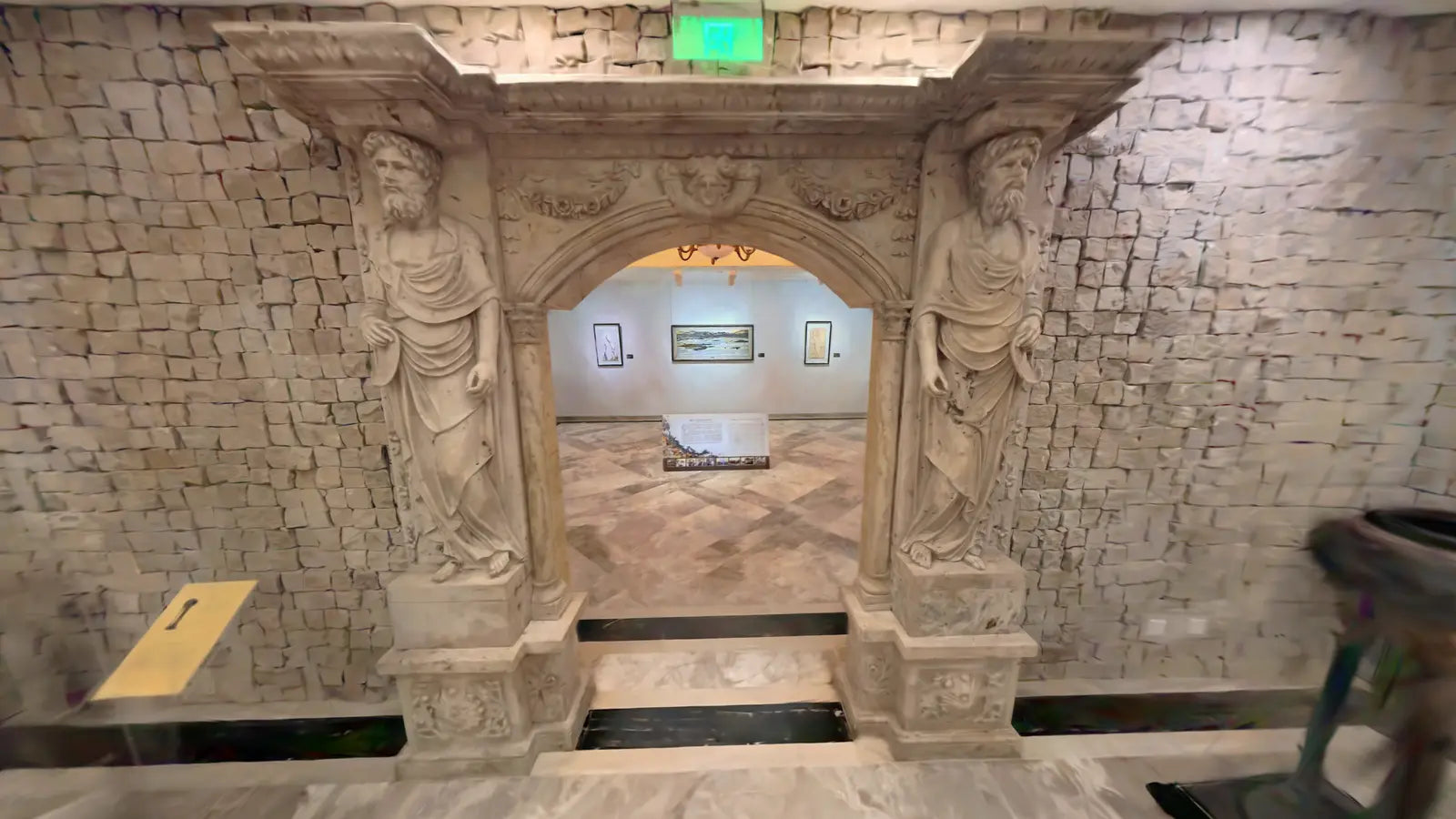
Photorealistic 3DGS and mesh output for cultural heritage preservation, metaverse environments, and game-world asset creation.
- Heritage site digitization
- Game asset scanning
- Virtual tour production
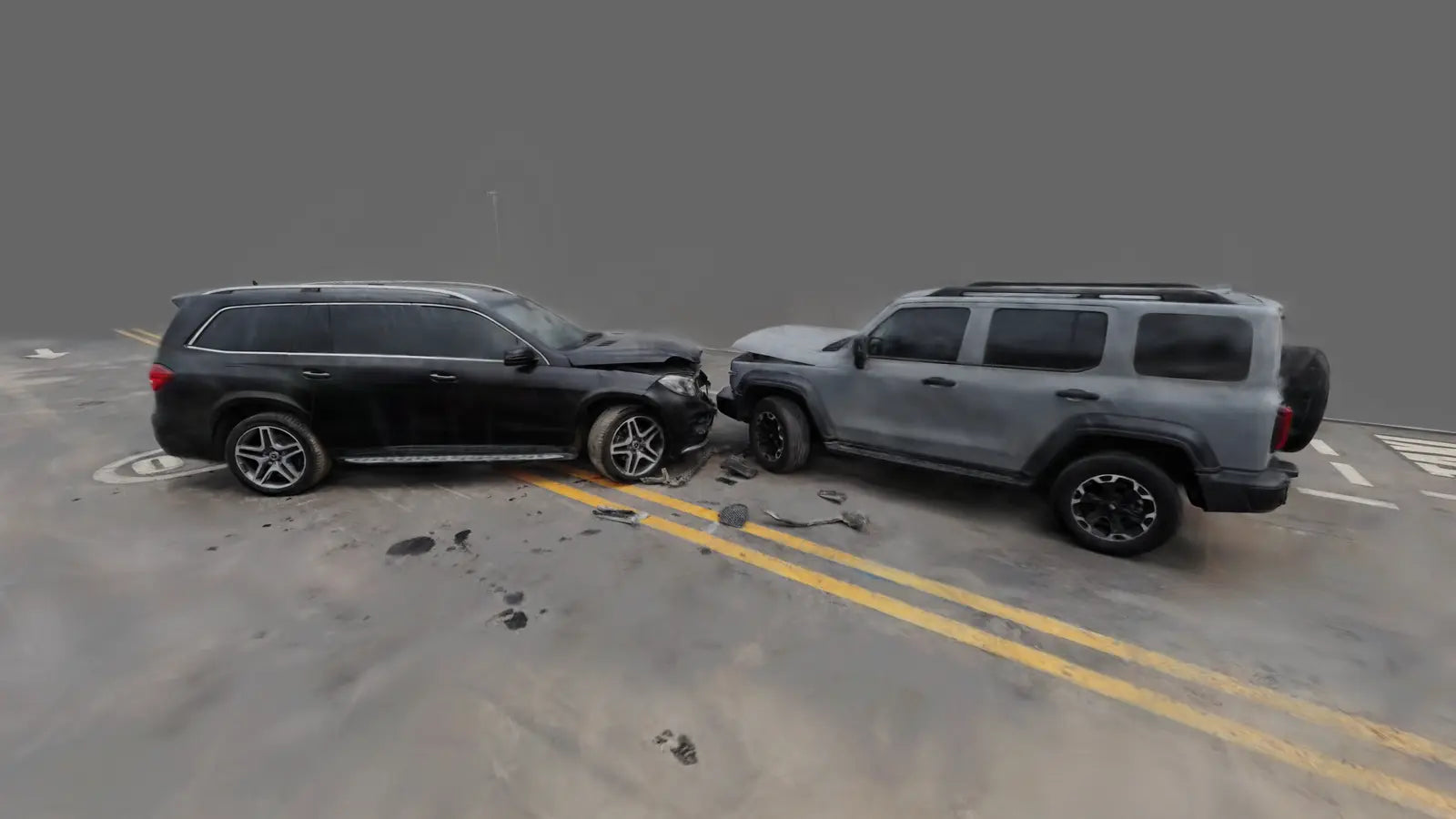
Accident Investigation
Rapid, evidence-grade scene documentation before environmental changes. Time-stamped point clouds and 3DGS models admissible for expert analysis.
- Traffic accident scene capture
- Fire investigation documentation
- Insurance evidence capture
Built for Every Field
Where It Works


SLAM GO POST Pro
Lifetime Free — No Subscription
SLAM GO POST Pro is a professional PC end data processing software specifically designed for Pocket 3D. It is equipped with its own core data processing algorithm and supports the one click generation of point cloud, panoramic images, and Gaussian model results. It integrates a full process tool for result browsing, visualization display, precise measurement, and interest point annotation. At the same time, it can complete the unified management, batch processing, and fusion combination of multiple measurement data, and complete the post processing of 3D data in one step.
- Point cloud cleaning & noise filtering
- 3DGS scene reconstruction
- LAS / LAZ / E57 export
- Colorized point cloud (with compatible 360° camera)
- Lifetime free updates


Proven in the Field
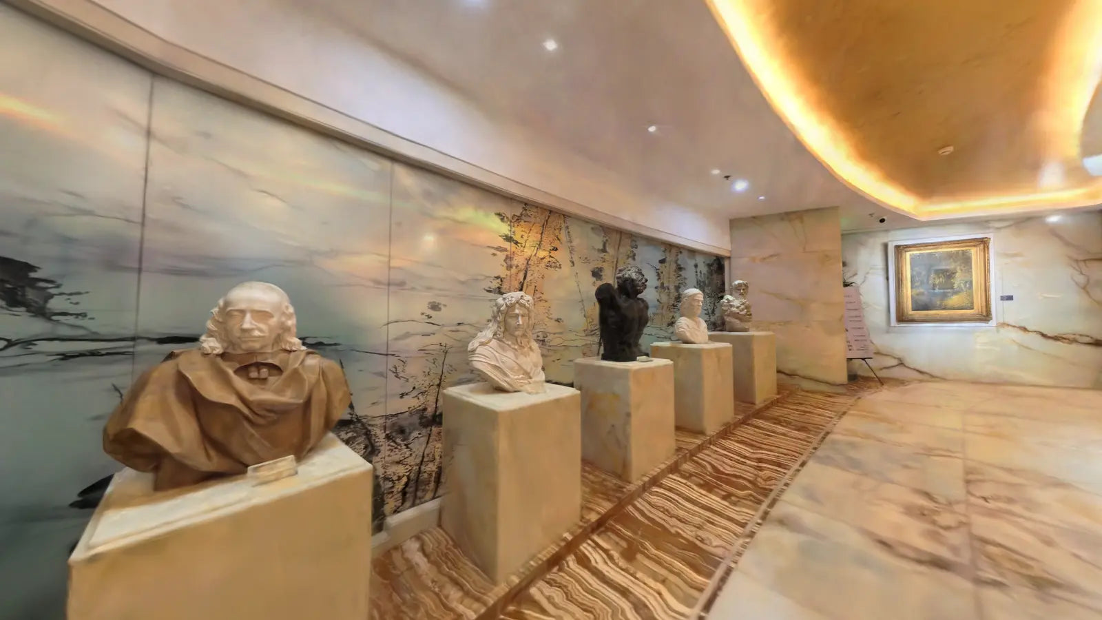
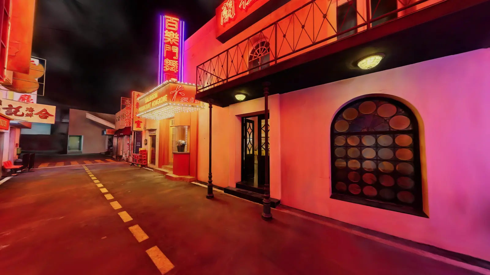
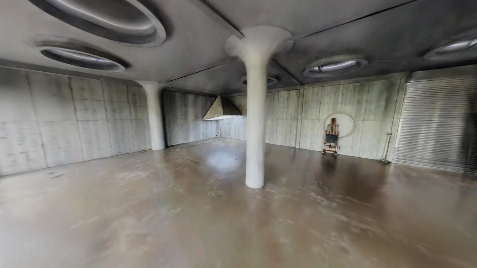
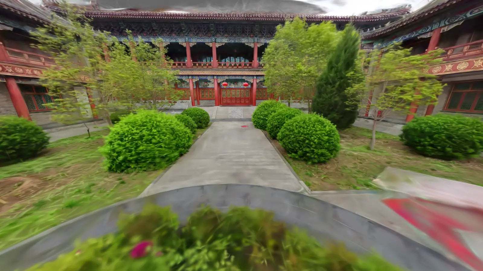
Real-World Scan Results
Captured by Pocket 3D — centimeter-accurate 3DGS point clouds in minutes, anywhere.
Ready to Capture Reality?
Contact our team for pricing and custom project consultations. Fast response guaranteed.